UNDER CONSTRUCTION
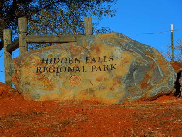
HIDDEN FALLS REGIONAL PARK 3X December 16, 2013
 With nice weather forecast, I declined to do a road trip to enjoy the weather up north, here. Waking up early, I didn’t see where I’d get a new computer this morning, so figured on doing a hike. The regional park by Auburn had opened some new areas, with new trails. Good for an easy investigation.
Taking Interstate 80 eastbound, I soon came to Auburn, CA, and took CA 49 north to Atwood Road to turn left (west). This turns into Mt. Vernon Road, and signs then show the way to Hidden Falls Regional Park. Forgetting to run any video, I came to the parking lot with many cars. Using the nice new restroom, I set out at about 10:50 a.m.
Seeing a mountain biker coming back up, I took the South Legacy Way which follows the creek downstream. It is at first a single track, rolling up and down, with sparse muddy spots and mostly damp dirt. There was ice in the culvert to the side, and I had to be careful to not step into any slippery mud. The track heads largely downhill, slightly, and passes over a footbridge. Coming to a junction, the route turned into a dry gravel road, which leaves the creekside and meanders over some hills.
At a junction, there is an abandoned home, with a outhouse which I used. Passing a pond, the road descends and my walking went fast. I came to the Salmon Run Bridge which marks the turn from the North to South Legacy Way. Doing video, I had my fun. This would be an easy day! Now only some 3.3 miles back to the bridge at the creek near the start, I savored my hiking, and slowed down to enjoy the day, better. There are many junctions with signs and maps, even more outhouses. I suspected that one day there may be a mountain lion sighting, but I heard some voices, as this area is surrounded by private property.
The road made for nice hiking, heading mostly uphill, but gently and rolling. Anticipating the falls, I finally descended to the new bridge, and an equestrian passed by. The ranger or maintenance fellow came by in his pick up truck, as I went to the overlook to view Canyon View Falls. Doing a good rest with drinking water, I ran some video, and then sauntered over to the platform for the Hidden Falls.
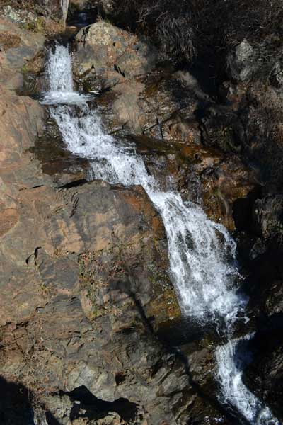 Having it all to myself, I shot video, and enjoyed the finish of this hike. Apparently for non hikers, they will take you to a hundred yards or so from this platform, with a short section of trail to have to hike. With things to do, I left to hike North Legacy Way back to the first bridge, and then did the short climb back to the parking lot. To my car by 2:58 p.m., my total round trip time was 4:08.
Motoring off, I took Mt. Vernon Road over to the Placer County Library and checked the papers. Discerning a sale on an item that I needed, I headed back down on Interstate 80 westbound to Roseville, where I purchased an electronic item that is useful to me. Filling up my tank at 3.259, I motored back into town, skipping a meal enroute.
Hiking then about 8 miles with 800 feet of gain, I drove 79 miles. Spending only the $35.75 for gas, then charging for the electronic item, I captured 322 images and movie clips (138.3 MB, 720p HD, 6:47). Used maybe 2 gallons of fuel. There were a few cows, squirrels, birds, and no ticks.
With no computer forthcoming today, I imagine that I’ll bide my time, and look, day by day, for hiking to do. Wishing to clear up my backlog of images to post, and videos from my Eight State Loop 3X, I don’t see many visits to my website or much interest in my activities. I take it as my buddy does his crossword puzzles, some mental work. Since my account was billed automatically the day I sought to ask about it’s termination, I relented to continue the information report for the few hikers and peak baggers that may find something useful. Without need to run my website as I have it, I’d now save thousands of dollars, and leave myself lots of time to do other things. But what good is camera work if you don’t share it?
BACK TO PETE'S
THOUSAND PEAKS HOME PAGE