SHORT 2013 FALL SOUTHWEST LOOP September 26 to October 1, 2013
Needing to lose some weight and get my health back, I had to do some more peak climbing. Deciding to view the fall colors out in Colorado, there was then extremely bad weather with flash floods about my destination at Rocky Mountain National Park. I had it first in mind to drive several passes over the Continental Divide. Looking like a major disaster out there, I decided to cancel that. There were more peaks to do, and I had to get in shape for 3,000 feet of gain day climbs.
Plan B was to head for Northern New Mexico. I had made reservations for a luxury two night stay in Las Vegas, made last May. For me, a once in a lifetime treat. I had plans to climb both Wheeler Peaks, in New Mexico and Nevada, as well as a 3X on Humphreys Peak in Arizona. I’d have to get into shape.
On the Sunday previous, I had to go to the ER due to a overly strong beer. Feeling dizzy, it came to nothing. Going to the doctor to have it checked out, he said something like “inner ear.” Wednesday, I made my online reservations. I’d head down U.S. 395, and climb whatever peaks that I could.
 Thursday, the 26th, I left home at 8 a.m. Southbound on U.S. 99, I shortly came to head east on J7 for Oakdale, to get breakfast and gas. Taking California 120 eastbound, I shortly was driving through the remnants of the forest, burnt by the Rim Fire. The flames had crossed over the highway, but it wasn’t that bad. I made a photo stop at the Rim of the World Vistapoint. I took photos of more of the burn area as I motored along.
Using my annual park pass to get through the Yosemite National Park entrance station, I started with pictures and video. There were building clouds, and I banded my camera to my rearview mirror, to let the video run. The light was gorgeous, and the views were magnificent, as usual.
Coming to Tuolumne Meadows, and the Dog Lake Trailhead, I parked my car. Able to use the restroom there, I started my hike in mid afternoon. Seeking to summit Lembert Dome (9,450’) 4X, I took the trail to the top. Other hikers had also set out. I had four layers on, with jeans, as it was pretty chilly. Something new for my hiking, was to carry along a “pee bottle.” I now wouldn’t be too uncomfortable having to hold it in, anymore. An old plastic canteen from my 1970 hiking would serve as a container, so I would no longer ever have to pollute on a day hike. I wouldn’t need it, though, till my hike on Saturday.
Taking the side trail right to the summit, I rambled cross-country, thinking that a use trail was the regular trail. Shortly coming upon the proper trail, I was ascending the granite slopes to the top. Other hikers were standing about. Helping one hiker on the easy way to the top, I shortly summited. Doing pictures and a 360, snow had been falling, to the east, and even here. Not doing my video summit twirl, due to the hiker in the scene, I shortly left to help guide her down without injury.
Quickly going back the same way, I got back to my car safely enough. Motoring off on CA 120 eastbound, I shortly passed over Tioga Pass where it was snowing. Stopping by the minimart and restaurant by the 120/395 junction, I got some soup and drink. Then, it was a short drive to Mammoth Lakes, CA. Another good feeling, cruising in the low light of the late evening. Clouds in front of the setting sun lay ahead going west on CA 203.
Checking into my motel, I shortly headed out for Minaret Summit. I started with photos at the vistapoint, although there was a snowstorm over the Minarets. A couple other photographers were there. There was low evening light on the White Mountains to the east, and then it began snowing more heavily. One person claimed to be a famous Mammoth local photographer. It was too cloudy for any good sunset photos, so after it became darker, I drove off.
Back to my motel, I enjoyed my 4G connection which was pretty slow, but gave me a bit of information. It was said now that Mammoth has higher speed Internet, but I had declined to pay the fee for the Wi-Fi. Going for dinner before every place closed, I had some salad with steak.
 Friday, I was up a little later. Going for a fast food breakfast, I stopped by the U.S. Forest Service visitor center. There was a new building, and I chatted with the rangers for a bit. Buying some things at their store, I shortly headed out to U.S. 395. Heading south, I’d do another peak today. By a look at the Sherwin Grade Vistapoint, I saw that it had not snowed so much down here. It was now clear, sunny weather.
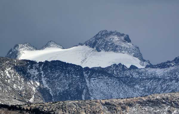
Going to the Bishop USFS ranger station, I arranged for them to know of my hopeful safe return by my note slipped under the door after their closing hours. My goal for today was Chocolate Peak (11,858’), my 3X. With the magnificent morning views of the high peaks driving southwestward to South Lake, it was great being back in the High Sierra. I shot video and pictures of the fall colors starting to appear.
Coming to the South Lake trailhead, I started my hike at about 10:30 a.m. Snapping lots of pictures, I carried a pretty heavy pack for safety. In the brisk morning, I had on a warm jacket over my Hoody. There were other hikers and backpackers. After over an hour, I came to the trail junction for Chocolate Lakes. Knowing it was a pretty rough trail, from my hike many years ago, I took it on upward. I had to scout a bit for navigation, but I correctly remembered that way.
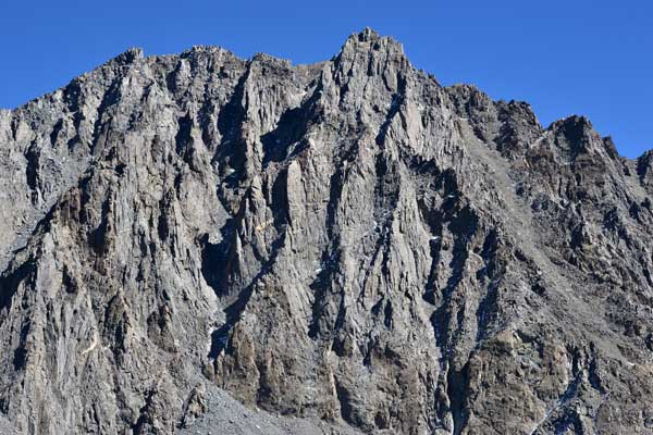
My time seemed pretty good, and the altitude then didn’t affect me too heavily. Taking pictures of the many lakes, I was soon coming to the col that marks the class 1-2 departure point for the summit. Resting well at the saddle, I had to decide whether to do it. It is a short amount of gain to the summit, but there could be an injury. I’d be back later than I expected, and I was alone. Figuring to do it, I shortly found a use trail. Navigating my way up, I saw it wasn’t too much further. After passing some low false summits, I saw that I had it in the bag.
Topping out, my time was about 3:20. Only for about 4 miles one way and 2,000 feet of gain. Happy that I made it, I started with first, my 360, then more pictures, and did my video summit twirl. I changed to my telephoto lens, and snapped pictures of the distant peaks. Then, other hikers began coming up. It was a nice, clear, sunny day, and I was sure enjoying this! There was a register, and I looked through it. A few names that I knew. Chatting with another hiker, I liked this, and with lots of time to get back down, with company on the trail.
Finally starting down, I took the trail to Ruwau Lake to make a short loop. Alone again, I had to be careful. Eventually coming to the Bishop Pass Trail, I took a rest. Hikers with dogs, and then backpackers, on my way back.
Back to the parking lot at about 5:30 p.m., I had some water and needed a drink. Driving down the road to Aspendell, I sought to get some soda, but they were busy serving dinner. Zooming down the road back to Bishop, I went to the coffee shop to get a smoothie. I had gone by the USFS ranger station to let them know I was safely back, by my note shoved under their door. In the mood for a good dinner, it was busy here in town.
Now heading south on U.S. 395, I stopped in Big Pine, CA, for a filet mignon dinner. Two peaks, then, with a third the next day! With a quick stop in Lone Pine, CA, I was finally coming to Ridgecrest, CA. Arriving late to my motel, I was feeling pretty good.
 So Saturday, the 28th, I wanted to do Morris Peak (7,215’) 2X by the PCT. I had free Wi-Fi now, but then went for a fast food breakfast. Motoring to CA 178, I came to Walker Pass. Making ready for my hike, I again had a heavy pack. It was another clear, beautiful, sunny day.
Taking the Pacific Crest Trail northbound, I strode up, making good time. I took plenty of pictures of the trail ahead, and shortly climbed up to the first saddle. I took a rest and used my pee bottle. I had filled a cup back at the car. Looking to get a signal, I was alone, but couldn’t get much here. I hiked up nicely, as it is 6 miles to the turn off for the peak.
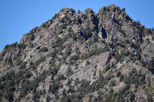
Making good time, I caught sight of my peak destination, then came to the saddle with the use trail to the top. After a rest, I started up. Finding a solid use trail, I weaved my way up steeply through dirt, trees, and rocks. My memory of this short distance was that it was easy. Rounding a few ridges, I had the top in sight. Three other hikers were already on top. I clambered up to the class 2 summit rocks and completed my ascent.
Starting with my photos, I chatted with one of the other hikers. They finally left, and I did my summit twirl video, plus my telephotos and a 360. The weather was perfect. Calm, cool, with sun. A register. Using my device, I got a 4G signal. E-mailing a summit photo to myself, to see if it worked, I watched a movie trailer. My downloads were perhaps a bit slow, but I got my data done.
Shortly starting back, I stepped down the dirt trail. Shortly back to the PCT, I took a slight rest. Drinking more of my water, I started hiking back. I had to use my pee bottle again, but it keeps any pollution out of the back country. The hiking clubs may leave their tons of human waste, but that is not me. I like it that I’m not making animals or other people sick! The trail hike back went pretty quickly, and soon I had CA 178 in sight. Getting to my car, I shortly drove off.
Motoring back to U.S. 395 south, I sought to get some food and drink. Onto California 58, I was headed east for Barstow. Getting my bargain room with free Wi-Fi, I was enjoying the best of the economy lodging. Walking onto the main street for dinner, I enjoyed a prime rib salad.
 Up early Sunday morning, I walked out for some coffee and diet soda. Back to my motel, I got the news and Net information. If my car somehow didn’t start, I had planned to take the bus so that I wouldn’t miss my luxury lodging. Having some low-calorie fries for breakfast, I headed north on Interstate 15. Taking a long soda and Wi-Fi break in Baker, California, I killed some time before the hotel check-in. Using the new highway rest area just west of Mountain Pass, I took some photos of the signs.
Before I knew it, I was coming into Las Vegas, Nevada. Arriving at my five diamond luxury hotel by Noon, I parked in the garage and headed for check-in with my two small backpacks. There was a line and crowds of people. They were gracious and nice with everybody, and I finally got my room key card.
Perhaps the best urban view that I have ever seen awaited me at my hotel room. I started recording the window view, happy that they had not stated any problem with me taking as many pictures as I wished. Familiarizing myself with the deluxe accommodations, I set up my camera to do video. The synchronized fountain show began to run, and I made sure I would have a good record for the world to see, if anyone was interested. Liking my stay already, I took more photos of the extras.
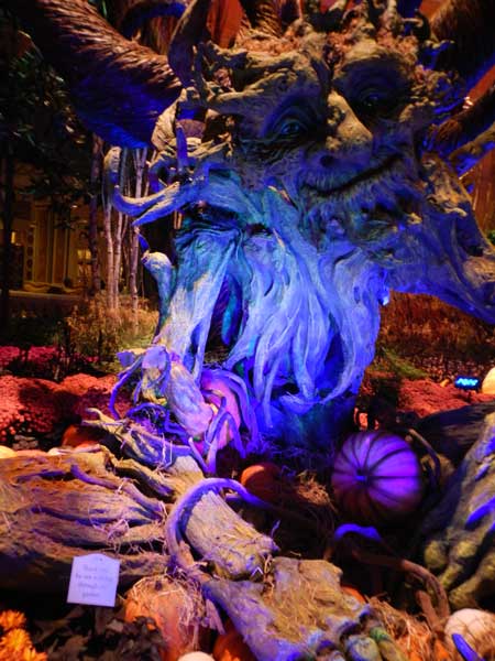
Getting some fine dining in already, I enjoyed dim sum, then a luxury meal. The fall theme at the Conservatory was nice, though so familiar. Back to my room, I enjoyed doing long-running video of the fountain shows. Using Internet phone calling, I spoke with my old hiking buddy. He wasn’t too interested, as he is elderly, and isn’t interested in very much, except about himself. This would definitely be my best Vegas stay ever.
No one is interested in seeing any of my pictures or video, but I made sure my photos and video were downloaded and backed up on the spot. Going back to the Conservatory, I had captured more pictures. My bed was super comfortable, and I had a flat screen TV. It had been a good magic hour and sunset, with red clouds.
 Monday, I was up early again. I went for coffee and breakfast, then was capturing the sunrise. Wishing to try out the fitness room, it came gratis with my room. Spending about 45 minutes on the exercise machines, I got my daily workout. The nearby Conservatory had again made for lots of photos and video.
Somehow tired, I lay in bed for a while. I captured more of the view from my window, and rested and relaxed. The government shutdown was impending. The National Parks would close, and perhaps I would not be able to do my peak hiking. I’d wait to see what would happen. Going down to the casino floor for food, I decided to gamble a bit. Playing 21, my luck wasn’t so good, and I lost 45 dollars. I had hoped to play big, and win small, but that didn’t seem like any good idea, now. Going back up to my room, I would run video for the rest of this night. There was a soda machine right by for drink.
Tuesday, I was up early, again. Running video again, I would seek to run it in high speed, to capture the sunrise. Figuring on splurging, and getting in-room service, I ordered breakfast. After about 20-25 minutes, I heard a knock on my door. There was a man with a cart/table, and he wheeled it into my room. I had fun running video of myself consuming my wonderful meal.
Last night, the news was that a government shutdown would occur. Not wishing to arrive to my hiking destinations to find that the trails were closed, I canceled reservations from here on. There was no place that I could hike whereby I wasn’t infringing upon skeleton crews and possibly emergency staff. I’d head home.
Spending time doing dictation, creating my notes for this trip, I shortly packed up my things. About an hour before the check-out time, I did that online, and reviewed my bill. Depositing the room card keys, I carried my two packs back to my car. So ended my deluxe Vegas stay.
To Interstate 15 southbound, I filled up with brand name gas at 3.399. Using the new rest area past Mountain Pass, I stopped again in Baker. Having lunch of some more low calorie fries at Kramer Junction, I took CA 58 to CA 223. New highway for me. Coming then to Interstate 5, I zoomed on north, with a burger, rest stops and one gas stop. My arrival time back home was right as my estimate, at 9 p.m.
Hiking then about 24 miles with 5,000 feet of gain, I had driven 1,446 miles. Capturing 2,172 images and movie clips, I spent about $327 cash, and charged up some $806 total for lodging, with an adjusted $654 for my luxury two night stay in Vegas, dining and extras included. Using about 32 gallons of gas, I paid $110 enroute, with extra fuel both before and after in my tank.
Should government services return to functional, I still yet may be up for peaks and fall colors. It is said to be due for the high mountain fall color peak in a week or so, if not later, about my planned destinations. A flight and car rental would not be out of the question. As my old hiking buddy and others say, "You can't take it with you when you go." Reading of impending financial doom, it seems smart to live it up while you can. What good is money when you can't spend it?
BACK TO PETE'S
THOUSAND PEAKS HOME PAGE