June 1, 2013: U.S. 20 east, Ochoa Overlook, John Day Fossil Beds National Monument, U.S. 26 east to Ontario, OR
Up at a good hour, I had an early breakfast, with getting gas. My long drive today was to take me to Eastern Oregon, declining then to lodge or camp, partway along. I had some plan to drive the rest of U.S. 395 up to Pendleton, OR, but changed my reservations on the fly. Easy to do with a convenient app.
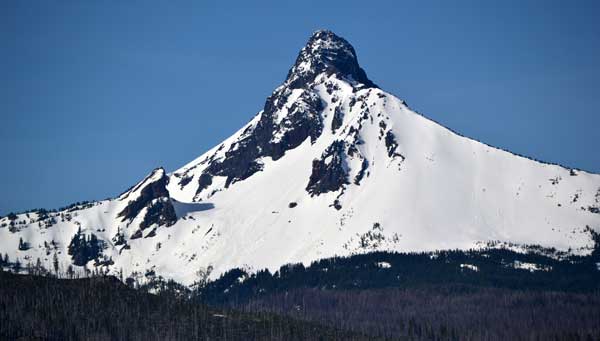 Eastbound then on U.S, 20 again, there was morning mist or fog. Dissipating soon, I shot photos ahead as I came to towns, new country for me. Stopping for breaks and drink, I then was into the mountains, on turning and twisting roads, the view ahead obscured by the sun. Not delaying, I passed over Santiam Pass, not seeing the waterfall turnoffs. I had no annual park pass, so would then have to pay the use fee, some $5 or so as I recall. The time and money to see what I had already well seen and photographed wasn’t worth it today. McKenzie Pass was open to cyclists only, but I made a photo stop to see Mt. Washington, a difficult peak.
Making it then to the fast food and gas in Sisters, OR, I had drink, food, and a break, good to be away from the crowds and urban situations of the Interstate. I used my device, and then the restroom, again. Thinking of property, this is fairly undeveloped land, and Bend, OR, has had a real estate crash. Rains too much in winter in Oregon, mostly for me, but it is drier out here, and maybe if I win big at Lotto, I’d have a mansion here.
Taking then OR 126 towards Prineville, there were open hills and hazy sun. The Ochoa Overlook provided a photo op, and then I was onto U.S. 26 and into Prineville, OR. There is a new server farm here, and I looked on my maps app, even doing a search, but came up with nothing but an eatery. I know they wish to keep it secret, and don’t want crowds or disturbances, and they seem to be doing that. My data may be stored here, or back-up, and the electricity sources used here are dirty, though cleaner at other server farms elsewhere. I filled up with gas, washing my windshield, as I know it’s scenic to me, ahead.
The motoring east was fine, with even cyclists using the lesser traveled highway. Not scenic enough for my running video. I was awaiting new hardware, with tons more storage, but I anticipated more data than my ancient computer hard drive would allow for, and I was right.
 I began to worry about a sudden memory card failure, and my work would be lost. On the road back-up was defeated by the unsupported new cards that I was now using, though I hoped for a firmware update or something. The computer company has stores in many more towns, and I’d be passing a couple by. Tech support blamed it on the formatting, and I had been advised to secure some third party software to be compatible with my tablet. I had done a search, and found nothing. There is no way to format the cards with the camera other than to the standard ones, and now I had data, and so formatting was out of the question. This was a risk, and I had no way of knowing ahead of time what superb photos and video I was now getting, and now, I needed back-up. I had checked the card manufacturer website and it seemed that they do not list the card model on their selection bar, and then my e-mail about data retrieval by the company went unanswered. More worries, now, that I was on the road.
So, I didn’t go too far to get great work, as it might be lost. I didn’t take much time to frame or compose my shots, or to wait for better light. There are cameras with dual memory card slots that will save to both cards, but I have my old, low end DSLR with no plans to upgrade to expensive models. With cheaper cards, it may be smart to have triple slots!
My first, day’s destination was the Painted Hills Unit of John Day Fossil Beds National Monument. I took the turnoff road, and mounted my camera to do running video. I didn’t do it right, so it didn’t record, and so I missed the wildlife shots of animals running in front of my car. There is no entrance station, so I drove up to the overlook, and found then that my video didn’t capture. So, I did the hike to the higher overlook, getting the sights, and then came back to my car and reshot part of the drive, from about the park unit entrance to the trailhead. No people the second time to get into the movie.
Going by the visitor center, it was closed, but I used the restroom, with people picnicking. Back to U.S. 20, I headed east again. Desolate highways, but mildly scenic to me. Coming to Picture Gorge, I did handheld video, with no time to mount the camera. Taking the side road to the Sheep Rock Unit, I parked and entered the fine visitor center, speaking at length with the friendly help. They couldn’t tell me much about outside the park, but did have useful and interesting information. They advised of a road and lookout, but I had a long drive, and it’d take more time than I had. I can change my plans, but I didn’t check the connections out here, figuring there were none, so left. I set my camera again for video to the overlook outside the monument, liking doing this. I had mentioned my pursuit to the ranger, and got no askance look.
 In the future, perhaps, a top mounted camera for higher POV, a dash screen and voice control would be deluxe. Zoom would be great, too. Spray jets and a wiper to keep the protective glass clean, in front of the lens. My car was getting bug hits aplenty, and it's good by me to have water and a squeegee in my trunk, available at all times.
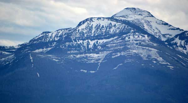
Cruising on east, the temperatures were pleasant, and the light was now coming from in back of me. I came to John Day, OR, and rested well with fast food and drink. There was a dining op in Ontario, OR, but I didn’t wish to rush, and when you are here, you might as well enjoy. The Strawberry Mountains still had lots of snow, and I have been to John Day a few times already. I had it in mind to camp, but wished to see U.S. 26 in full, having driven OR 7 awhile ago.
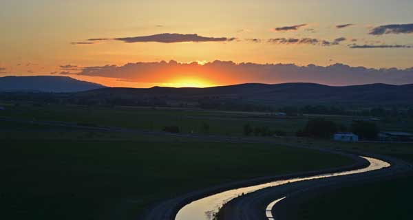
Late in the day, there was little traffic. I made a photo stop at a vista point, and motored on. Soon, I practically had the highway to myself. I handheld more video, and shot sparingly with my memory storage concerns. A cattle crossing was cute, with a rancher there. Clouds with sun marked the quiet country, and finally I was coming to Vale, OR. A country store allowed for a break, and I asked about food. Friendly, but I’d go into town. I changed my clocks for now, with a wavering time zone line here.
Turning left (east) on U.S. 20, it was back into civilization, making a stop at the restaurant which was closed by now, due to the Mountain Time lag and my leisurely driving. Beelining for my motel, I had to mention the one minute check-in by the same staff that had done that last year. Some motels may take hours, but this is exactly why I like Ontario, OR. Five stars, by me. Or a line of tens on any survey!
With a few fast food stops this day already, I got something from the motel vending machine, to retire early enough.
Summary, 30, 31, 1, 2, 3, 4, 5, 6, 7, 8, 9, 10, 11, 12, 13, Movies
BACK TO PETE'S
THOUSAND PEAKS HOME PAGE