8 STATE LOOP 3X May 30 to June 13, 2013
May 30, 2013: Interstate 5 north, Mt. Ashland, Medford, OR to Oakland, OR
 I awoke by about 6 a.m. on this Thursday morning. I had made my reservations ahead of time, and long had figured out my initial plan. Feeling O.K., I wanted to do this. I carried my gear out to my car, and left home after checking everything. My power was shut down on my items, to spare minor energy use, as I might be gone for up to three weeks.
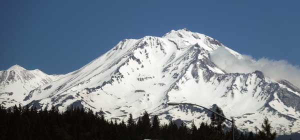
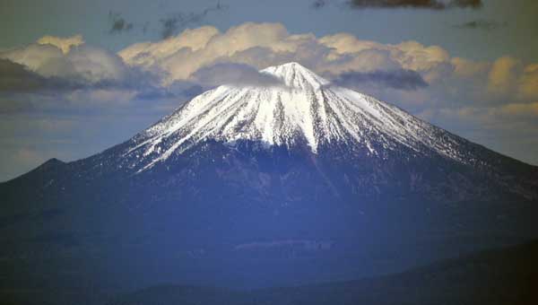
Leaving home at about 7:40 a.m., I took Interstate 5 northbound. Getting gas at the usual exit before Woodland, CA, I filled up my tank with regular at 3.819. Traffic wasn’t bad. I had a fast breakfast in Willows, CA, and then stopped at the rest area by Red Bluff. Bored, I shot video as I drove, of myself, requiring less attention than someone lighting up a cigarette, say. I had more food, then passed by Mt. Shasta. There had been work areas on the Interstate, and I slowed down for all of them. Safe driving is my highest priority, and while I witnessed many careless drivers speaking on their cell phones, paying little attention to what they were doing, I managed to avoid them.
I visited the USFS ranger station in Mt. Shasta City, CA, seeking information. I spoke briefly to inquire about hiking, and wished to thank them for the good information on my last stop here. I even considered canceling my plans and staying here, as the hiking was good. But, I can do this again, later this summer.
Motoring on, I figured to hike Mt. Ashland (7,533'). I knew that it is a short climb, and I had the time. I took the freeway exit and drove up the forested road. Some road work ongoing, but I’d be doing video as I drove back down, to capture the beauty of this high area. I came to the now near empty ski area, and had some knowledge of the route from my plans last year. I found the dirt road that goes straight from the ski area and followed it up. It goes left around the peak, and then I came to a dirt road with a sign that looked like it led to the top. Parking my car, this would be my first peak for the trip. A blader came down this side road, and said that it would be ready to drive in a few more days. I asked if it was O.K. to hike, and he said it was fine. Other people sought to drive the road, but I’d save my passenger car, and walk.
 Taking my pack, I hiked up the dirt road, and was pleased to be doing this. Nice views, and then I came to snow on the road. Other cars had parked, and some skiers were toting their gear on their packs, intending to do some jumps, even to make it better with a shovel and some digging. I followed the dirt road up, and finally came to the summit area. There is a communications facility, and I hiked up a short use trail to the high rocks, topping out then in 38 minutes.
Doffing my pack, I started with photos and video, with telephotos of the distant sights. An auspicious start to my road trip. I did my 360, and made sure to get everything right. I usually brought along three cameras, with separate memory cards. Back-up is very important to me. These are glorious moments to be shared with the world. Shame to be careless and have a memory card failure, with no other memory cards with similar data. I had learned my lesson from my April 2013 Oregon trip, and while some occasions can’t be recorded with multiple cameras, unless I had some big disaster, I’d have something to work with and share from the trip.
I finished with the views, and started down. Seeing them close by, I walked over to a snow slope to the north, and three skiers were doing jumps off the ten foot high cornice. Obliging them with a photo as they leaped, I offered a free picture if they e-mailed me by my website link, giving them the website name and search term. They weren’t filming themselves, as it wasn’t much to them, and they were pretty calm about it. Fun for a late season day.
Hiking back down the road, I sought not to slip on the mud or snow, and came back to my car at 4:06 p.m. Seeking some fun, I banded my camera to my rear view mirror to have some video as I drove downhill. I have to adjust the camera often, as it is a crude set up, and level shots are important to me. Better to have a dash cam, but looking, a search came up with expensive items and nothing that I can have done affordably in short time. There is a question of legality, too, and privacy rights, but I try to do this with no or little traffic on remote, scenic highways, and as I am operating with zero budget and as a hobby, you get what you get.
Motoring slowly down the dirt road, the camera ran, and then I stopped to see that it was working, as I was to do much of this. I continued down the paved highway, a good drive for this part of Oregon. Coming to the stop at the end, I halted the shooting, and got back on the Interstate.
 Northbound, I didn’t need any stop till I reached Medford, where I went back to the tapa house in the old part of town. I had the first fine dining for the trip, good on time, with the first of many non alcoholic beers. I looked at my device to check on the driving and distances with times, so I knew how much effort with how much estimated driving time lay ahead for me.
The sights made for more photos as I drove, as I am well used to snapping a quick photo, with one handed operation of my zoom to catch the sight ahead. Having done thousands of road photos, I can also do video as I am driving, with my eyes on the road, and capturing the feel of the landscape and highway passing along in front of me. There are many passes to cross, and then I was passing Roseburg, with some driving requiring my attention. There is a section that is narrow, and with no lane changes allowed.
My motel location referred to Oakland, but I stopped at the OR 138 Sutherlin exit for food. Coming to the Oakland Exit, I saw no sign for my motel. I turned around and went back to Sutherlin to have a smoothie and look at my device. It is at a further exit, Rice Hill, and I had to mention this to the desk clerk as I checked in. There were a number of misleading things that I encountered on this trip, but the way things get done. A first new stay at another location that I had not been to, and it entered my mind for another list completion of sorts. To lodge at all of the locations of a certain motel chain in one state. Some states will be easy, and it offers a new fun venue for me, less hazardous than peak bagging solo.
I got to my tablet and sought to get information on what to do for the next few days. For the whole trip, I used a bit more than 600 MB on my cellular, supplemented with free Wi-Fi. Mostly there was 4G, with some LTE and some 3G. Anywhere from one bar to four, and sometimes pretty slow, or even dropped. I never paid for motel Wi-Fi, then, as sometimes it’s worthless. While it has gotten better, I am reminded of times when I had to call motel management to get my messages. If someone is downloading a movie, forget even trying. It’s all networks.
Summary, 30, 31, 1, 2, 3, 4, 5, 6, 7, 8, 9, 10, 11, 12, 13, Movies
BACK TO PETE'S
THOUSAND PEAKS HOME PAGE