 The
weather was nice. I motored up U.S. 50 to exit at Shingle Springs,
CA. A side road leads to the vicinity of Coloma, CA. Green grassy
hills abounded, and the traffic wasn't too heavy.
The
weather was nice. I motored up U.S. 50 to exit at Shingle Springs,
CA. A side road leads to the vicinity of Coloma, CA. Green grassy
hills abounded, and the traffic wasn't too heavy.MONROE RIDGE TRAIL 2X March 6, 2004
Having to cancel from a big trip to the desert, I consoled myself with an easy hike in the Sierra foothills. I had stayed up till early this Saturday morning, musing on whether to make a lengthy day drive to Yosemite, or even a double peak hike including Mt. St. Helena. With gas over $2 a gallon (again), I settled on going to sleep and waking later in the day.
The
weather was nice. I motored up U.S. 50 to exit at Shingle Springs,
CA. A side road leads to the vicinity of Coloma, CA. Green grassy
hills abounded, and the traffic wasn't too heavy.
I motored to the central parking lot of the Marshall Gold Discovery State Historic Park. A ranger was ticketing cars, and I was able to get some change for my five dollar bill from the $4 use fee. I also was given a map, so started my short hike by about 2:26 p.m.
A very well built trail, with some rustic, wooden fencelines as side rails, heads up a half mile to the Marshall Monument. I feared for mud and overgrown foliage, with ticks, but I was to see none of these.
The spacious trail switchbacks up along the hillside to the west of the park. I came to the upper, paved road, with the monument, to snap a photo. This is the stuff of field trips by local schools.
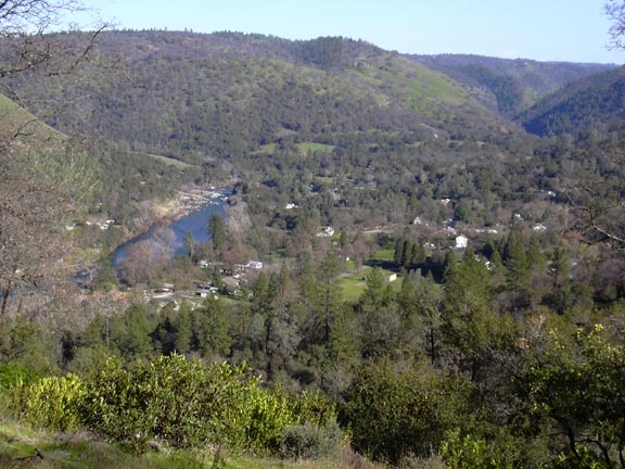
The trail goes on past the monument, and climbs to the top of a hill 1,276'. The wooded summit lent itself for some modest views in some directions. The trail gains some more views to the west, and I snapped photos of all of them. Descending through blooming manzanita groves, I spotted a few shooting stars. No poppies yet, as I knew they bloom into a golden carpet here in the Spring. Another view to the southeast was gained about another small hill. The Coloma area is perhaps the least developed of these views, even with CA 49 running through it.
The trail descends over a miners ditch, and then to the Monroe Orchard. I walked across the highway at 3:35 p.m., then over to the South Fork of the American River. There were a few kayakers and one rafting party. The total trail loop is said to be three miles, not enough for me, but it was getting to be late in the afternoon.
I viewed the historic buildings, structures, and replicas, walked over the river on a bridge, and toured the visitor center. Back to my car by about 4:05 p.m., I motored back to U.S. 50 via the same side road.
I'd done about 3.5 miles with 600' gain. I shot some 73 digital images.
BACK TO PETE'S THOUSAND PEAKS HOME PAGE