Finally able to settle in and to be enjoying my new digs, I looked everywhere for a partner. Regaining my energy after a good rest, I had already done a short hike to explore my new locale. Able to enjoy some of the best, most energy-efficient tech, I knew that I had it so good compared to when my energy went to help the presumed hiking club. That none of them have the slightest interest in the finest explore, enjoy, and protect, points out them and their ways.
This glorious holiday, I was determined to climb to the mountaintop. None of my online contacts seemed to be interested in even five star lodging, all paid for, to help them to enjoy the luxurious surroundings that I would afford them. As I proceeded to leave for my day's activities, I found that my car service engine light no longer came on. So I am free for the week, versus potentially expensive car repair, contingent on my contacting the dealership that this isn't a problem.
With my dash cam on, I initially thought to recycle some old sandals. The enviro friendly clothing store must've been busy, as my reply was delayed. I had first in mind a climb of what I call “Patagonia Hill" by Mayberry Park. As I drove, I started thinking. With my new electric car, I will be limited to going out 40 miles out, at a time. So, as I like energy conservation, it makes sense for a close by, regular, recreational goal. Well, what I call the “Mountain,” for this part of Northern Nevada, made for an excellent objective.
I could still remember the way to go from 23 years ago. My dash cam would make for another high-speed video showing that this dirt road was accessible to a passenger car, with at least as much clearance as I have, over 5 inches. I began to think of making this an official recreation goal. A city or state park designation would serve that perfectly. Speaking to users along the way, I began to assess sentiment for such a cause. The local paper just published an article about shooting in the area regarding hiker safety. There might be campgrounds, improved roads, facilities, a visitor center, and with other services made available. Some users preferred that road remain rough to keep people out. Myself, I like it that more people enjoy and appreciate the area. Businesses could benefit with increased traffic to the area, and even by additional jobs to provide increased taxpayer base for more city services. Unless you are dead set against mountain tops and public access, I can't see how this can lose. The way that the politicians like it that everyone is accommodated, there can be designated areas for safe shooting, and even a challenge road for 4WDs and ATV users. With money, they can have some of the best mountain biking in the area. Reno seems to be a good volunteer town, except for the hiking club. Get them out of the way, and this town can really prosper!
Intense blue sky and bright sun urged me onwards. The road to the top is only about 7 miles one way from pavement. Forgetting which one was higher, I chose to go to the easiest one first. There were rocks, and some driving skills required. As I approached the lower summit, there was mud, and snow on the sidebanks. Beforehand, I thought that with my bad eyes, an archer was aiming for my car. In the style of the movie Avatar, I was initially fearful that it was some nut job aiming for my tires. I have faith in people, so instead of trying to speed up, I saw in a few seconds that he was aiming the other way exactly.
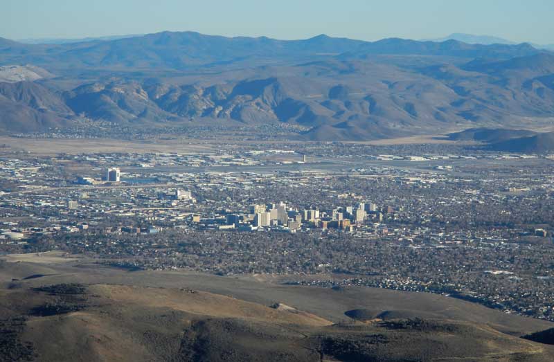
Successfully and safely driving to the top of the lower summit, some other hikers were already up there. I spoke to them of my thoughts for a State park. The overall sentiment was that they didn't want the crowds. Doing my photos with my cheaper camera, I didn't have my super telephoto lens, though I had no immediate idea in exactly which direction lay Mount Shasta. I couldn't see any trace of it anyway, as visibility wasn’t excellent. I spoke with a guy with a motorbike who was sitting there enjoying his drink with a pack of cigarettes. Apparently he is involved in construction work, and I have need of a major project. The sun was setting, and I had to go climb to the true top. I set my dash cam and motored down to the side road that I had to hike to the top.
I hiked this short, rocky, steeper road, taking about 10 minutes. It will be fun to look back at my newly stored pictures from 21 and 16 years ago, for comparison. The signs warning of interference with aircraft communications weren’t there anymore. Taking my pictures, I had to leave to get back to my car. Using my bottle, I could relax on the way down, as this is a watershed. Enjoying being out as I haven't for a long time, I motored slowly down the road. It was magic hour. I’d see how my dash camera did for that. Slow and careful with my headlights on, I was back to pavement at about the bottom. Anticipating a night of enjoyment at my computer working on speeded-up video, I had to get some food at the supermarket, then I came home.
Hiking about a half mile with 200’ of gain on the peak, or 1.37 miles with 8 flights of stairs for the day, I captured 148 images and movie clips, with perhaps 2 hours of dash cam video. Spent $20 for gas at 2.359 to fill up my tank from empty, and perhaps $75 for groceries.
I'll be looking at a week of business and hiking fun. It's just too bad that there will be no one to share even the fun, let alone the expenses. Not that money would make any difference to the hikers that I know.
BACK TO PETE'S THOUSAND PEAKS HOME PAGE