TELLS PEAK (8,872') 5X August 23, 2010
Finding another interested person by an e-mail, I had to determine whether he was right for peak climbing as I did it. He seemed enthusiastic and experienced, so I arranged a meeting. He is a capable, professional person, and showed me pictures of his past peaks via his camera screen. I attempted to interest him in a multiple use device, but he is not that type of person.
 We agreed to hike Tells Peak in Desolation Wilderness. It is an easier peak, and I wished such for my return to the Northern Sierra, for now. He had to be back early for dinner, so he came by to pick me up at about 7 a.m., Monday. I had the times on the peak from my notes, and figured we'd get back to town by 6 p.m.
Stopping at a Wi-Fi enabled eatery in Placerville, CA, I showed him what my device can do. Then, it was to the turnoff road for the trailhead. I had forgotten to stop at the main ranger station for a wilderness permit, but we got a self service one at the trailhead message board.
The Cheese Camp Road, as it is now called, goes to the Tells Peak Equestrian Camp, and our trailhead road is paved all the way to the short, dirt, side road to the parking area. Good to know this for my update on my peaks guide.
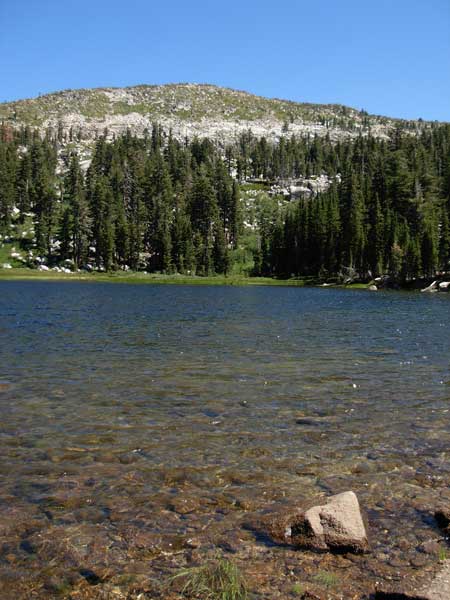
We started hiking at 9:45 a.m., and some mosquitoes landed on me already. The breeze came up, and I kept photo notes on the trail. There was a good wildflower show, but I'd capture some close-ups on our return. My peaks guide descriptions will still be about the same, but the trail is so indistinct and hard to follow. Some markers showed the way. There were some muddy bogs and streams to cross, but we made it to Forni Lake in fairly good time. I had a rest with photos.
The trail from here is very faint, and I'll call it a route. There were ducks and some footpaths to follow, but I had to scout the terrain and find the use trail. This took maybe 20 extra minutes. We topped the summit at about 1:21 p.m., and I started capturing the views. I had envisioned getting back to the cars by 4 p.m., but that was not feasible.
Drinking my water and getting a slight rest, we started down by 1:55 p.m. We lost the trail again, and I had to have my companion use his GPS unit. Back to Forni Lake, I had to rest again. I was tired from the altitude or what, and we had done poorly on time.
Stopping for some wildflower close-ups, I got us back to the better trail, and let him go ahead back to the cars. I was back by 4:51 p.m., and we shortly motored off. Our driving times were slow, too, so we didn't make any stops till back to town. It may remain to be seen if we do another peak together. I felt rushed by his proviso, and feeling that I really should retire from peaks, plan to see how I feel, and maybe try an easier peak yet.
We hiked then 10 miles with 2,400 feet of gain. I captured 122 images with no movie clips, and spent about $2 for drink and food. The drive was a bit over 180 miles round trip.
Most hiking groups fail on this peak. You must know the way to follow the trail, otherwise there is brush with rock cliffs. I did not "need" it, but succumbed to doing my 5X, since, for once, I got a ride. It had been nearly a month since my last gain, and rise to elevation. I look forward to doing some more peaks, but I feel that I am getting too old and slow. However, some more hiking may help with that!
BACK TO PETE'S
THOUSAND PEAKS HOME PAGE