LAKE CLEMENTINE LOOP March 9,
2008
 In need of
some hiking, and with a few new items to test, I headed eastbound
on Interstate 80 and motored through Auburn, CA. To the Old Foresthill
Road, I quickly found parking to start my hike by 12:05 p.m. Plenty
of users were about. The weather was nice, and the river
flowed well.
In need of
some hiking, and with a few new items to test, I headed eastbound
on Interstate 80 and motored through Auburn, CA. To the Old Foresthill
Road, I quickly found parking to start my hike by 12:05 p.m. Plenty
of users were about. The weather was nice, and the river
flowed well.
Taking the Lake Clementine Trail, I sought
to see the trail conditions. A few wet spots and slight mud might
bar less determined hikers from proceeding further. From only
a few hundred yards up, then, of this, the trail was dry and clear,
aside from damp stretches.
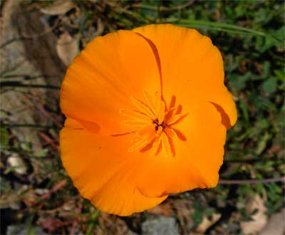
Looking for wildflowers, I saw a few poppies,
and tiny, other flowers, here. I did some close-ups as I could
get to them, and then decided to hike my full loop over the Foresthill
Divide. I expected lots of mountain bikers, but I encountered
only maybe 20 or so.
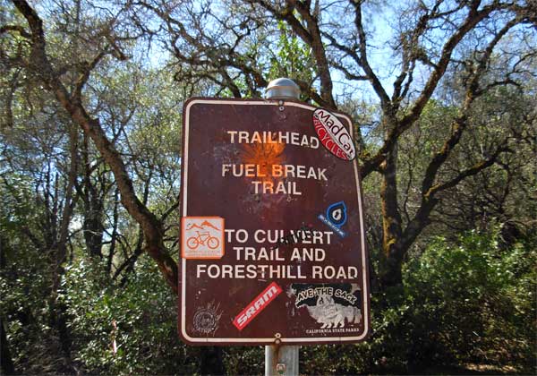
A sign at the start of the Fuel Break Trail
showed the dominant sport, on these trails. I was concerned about
impeding speeding cyclists, so kept looking in back of myself,
and certainly, a music player might drown out any sounds of approaching
cyclists.
Many new rocks, ramps, and bumps had been
constructed for jumps, and I snapped pictures of the potential
photo ops. It seems that hikers may now wish to stay away from
these trails, as I often stepped aside for the mountain bikers.
They come by with momentum, and they cannot brake while in mid
air.
With so many new single tracks, I wondered if I was on the Culvert
Trail, then came to the tunnel, and then to the ORV area side
road. Rangers were on duty, and I sauntered to the upper end of
the Confluence Trail. This descends back to the trailhead and
river.
 I
got a good view of the Quarry across
the canyon. I normally do this hike in mid-winter, when the light
is lower and thusly backlights the scene. More
flowers appeared, but not yet the tens of thousands that will
be starting to bloom, later.
I
got a good view of the Quarry across
the canyon. I normally do this hike in mid-winter, when the light
is lower and thusly backlights the scene. More
flowers appeared, but not yet the tens of thousands that will
be starting to bloom, later.
Some small rockslides crept across the
trail, and then I was closer to the Middle Fork of the American
River. Families were enjoying the rocky beaches and sights of
the rapids, and I declined many shots or movie clips. Back to
the highway and car by 3:05 p.m., I chose to get home early. Gas
on the way home was 3.449 on the Rocklin Road.
I count this as 6 miles, with 1,000 feet gain. I used my
light pack, with a shell parka over my T-shirt. Wearing light
pants, my old, worn, low cut boots did fine, with no sticking
mud, or much dirt, at all. No great number of bugs, and I shot
130 images and movie clips.
Traffic on the Interstate was moderate,
as it was a weekend. Turned on my a/c for the first time this
year. I drove only 75 miles round trip. This is a longer way for
people from the Bay Area. The bigger California cities don't have
such beautiful, rushing rivers, close by. The water was clear,
and the grasses were green. Too bad there isn't mass transit to
serve the foothills, as I'd imagine many commuters would love
to ride up here, and enjoy these glorious river canyons.
BACK TO PETE'S
THOUSAND PEAKS HOME PAGE